Contractors
Reducing business costs and maximizing yields, this is our goal


What can we offer you

Your benefits
Our goal is to increase your profit
Reduction in the use of fertilizer
With our remote sensing systems we are able to map each plot, and thanks to this we can identify areas with greater and lesser vigor.
We can then formulate prescription maps that are able to reduce the use of fertilizer by up to 30% in the case of cereals, while for horticulture we can achieve a reduction of up to 44%.
Reduction in the use of agropharmaceuticals
You have noticed that in some plots there are leopard-spotted weeds. So the question is why we don't just supply the agro-drug only on top of them. Reduction of the use of the agro-drug by up to 60%.
Variable-rate sowing
All soils have a spatial variability of organic substance and nitrogen content. Why not exploit this variability for differentiated sowing. We allow an increase in yield of 10%
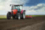
Reduction in the use of diesel fuel
Through the assisted driving and the automatic driving of the tractor it is possible to avoid passing twice in the same point and at the same time passing in every portion of the land.
Market price predictions
Our market price prediction system uses the "State of the art of artificial intelligence" for a more accurate forecast, so as not to leave you alone at the decided time of the year, the sale of your products.
Provision of satellite images to your customers
We can provide you with a platform with which you can provide vigor maps to all your clients to support your client throughout the year and improve your competitiveness.